Docs
Maps
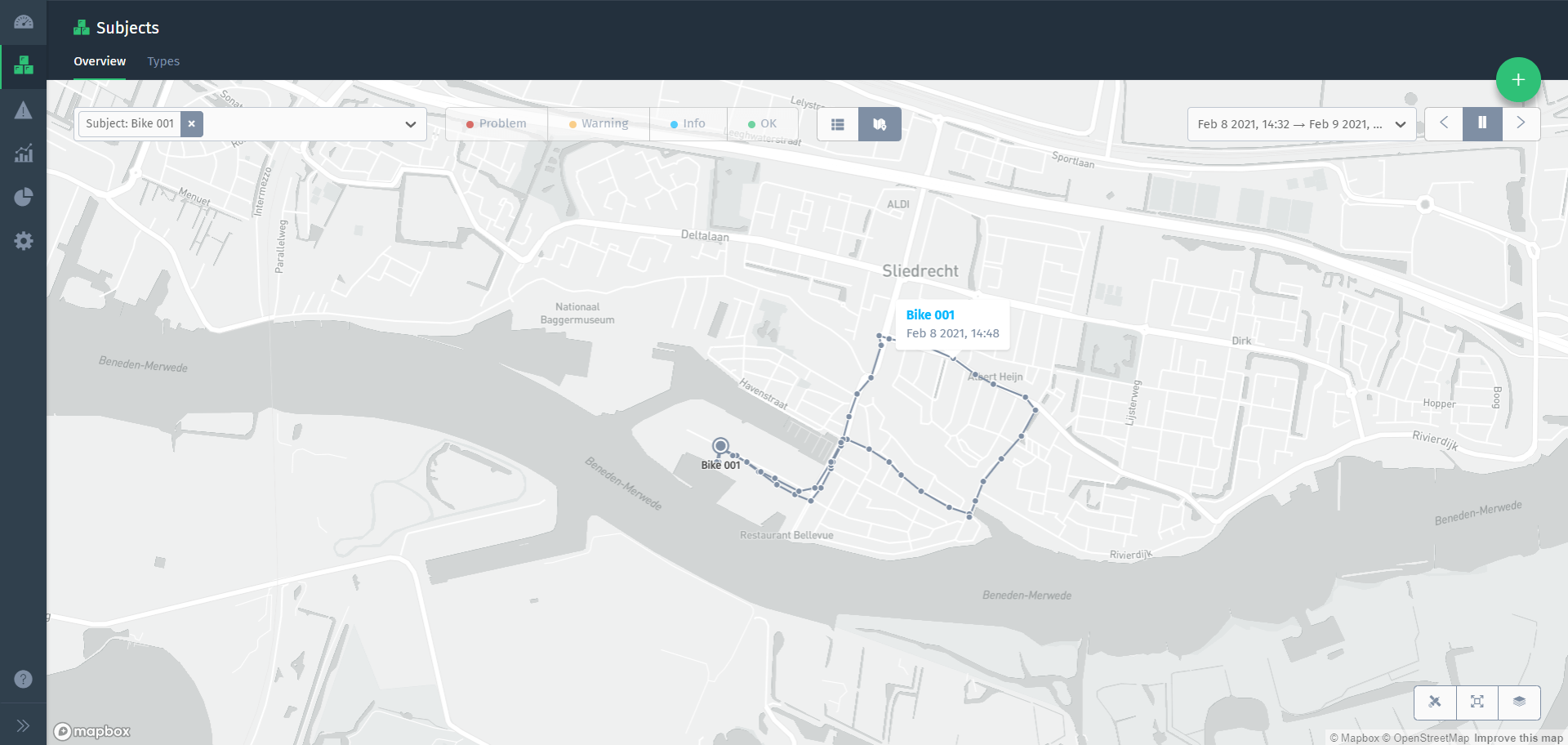
Subjects are often tied to a geographical location. A subject’s location can either be defined by a location property, or dynamically updated by sending its location as a metric.
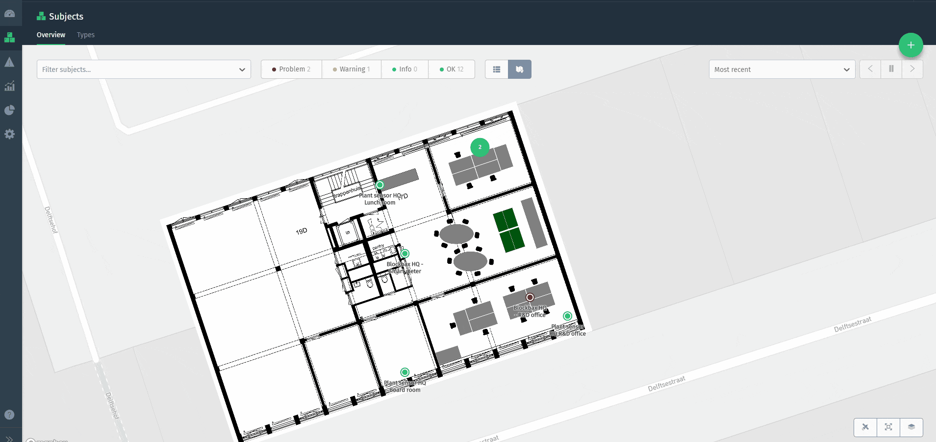
Using the map
Subjects are displayed on the map using their primary location. The marker color indicates the current status of a subject, to give you an instant overview of the health of your subjects. The filter options at the top can be used to search for specific subjects.
When a subject’s location is defined by a metric, updates can be visualized as a route on the map. Use the period selector at the top to select the relevant time window.
Adding layers
You can add schematic representations of your office, greenhouse, factory, construction site or any other space as an overlay to the map. Using overlays you can provide a lot more information about a subject’s spatial context. Manage map layers by clicking the layer button in the bottom-right corner (see screenshot below).
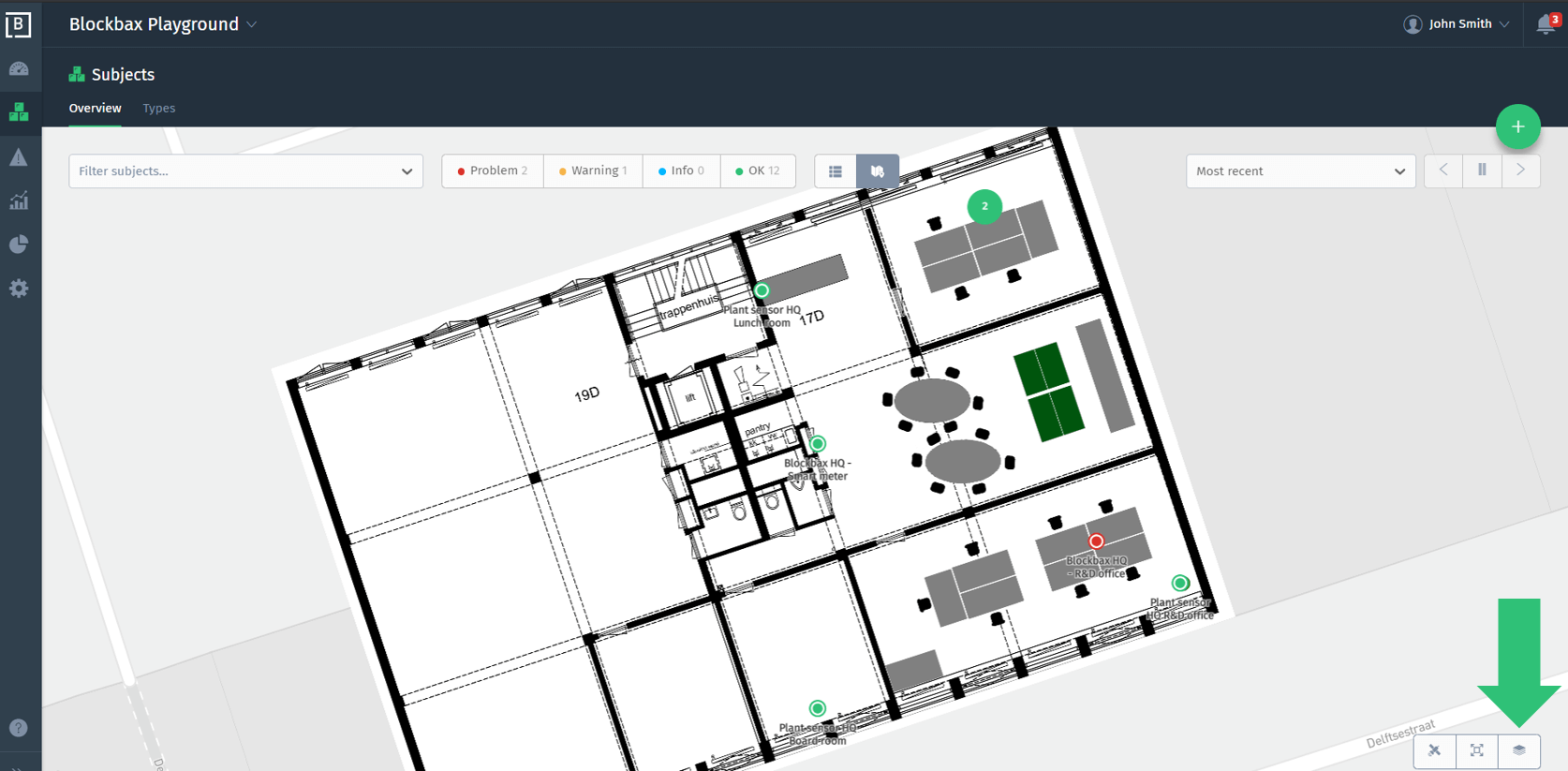
Here you see a Blockbaxer manage the layers and pinpoint a subject to the right spot: